
The Florida Keys From End to End: What Travelers Find at Each Mile Marker
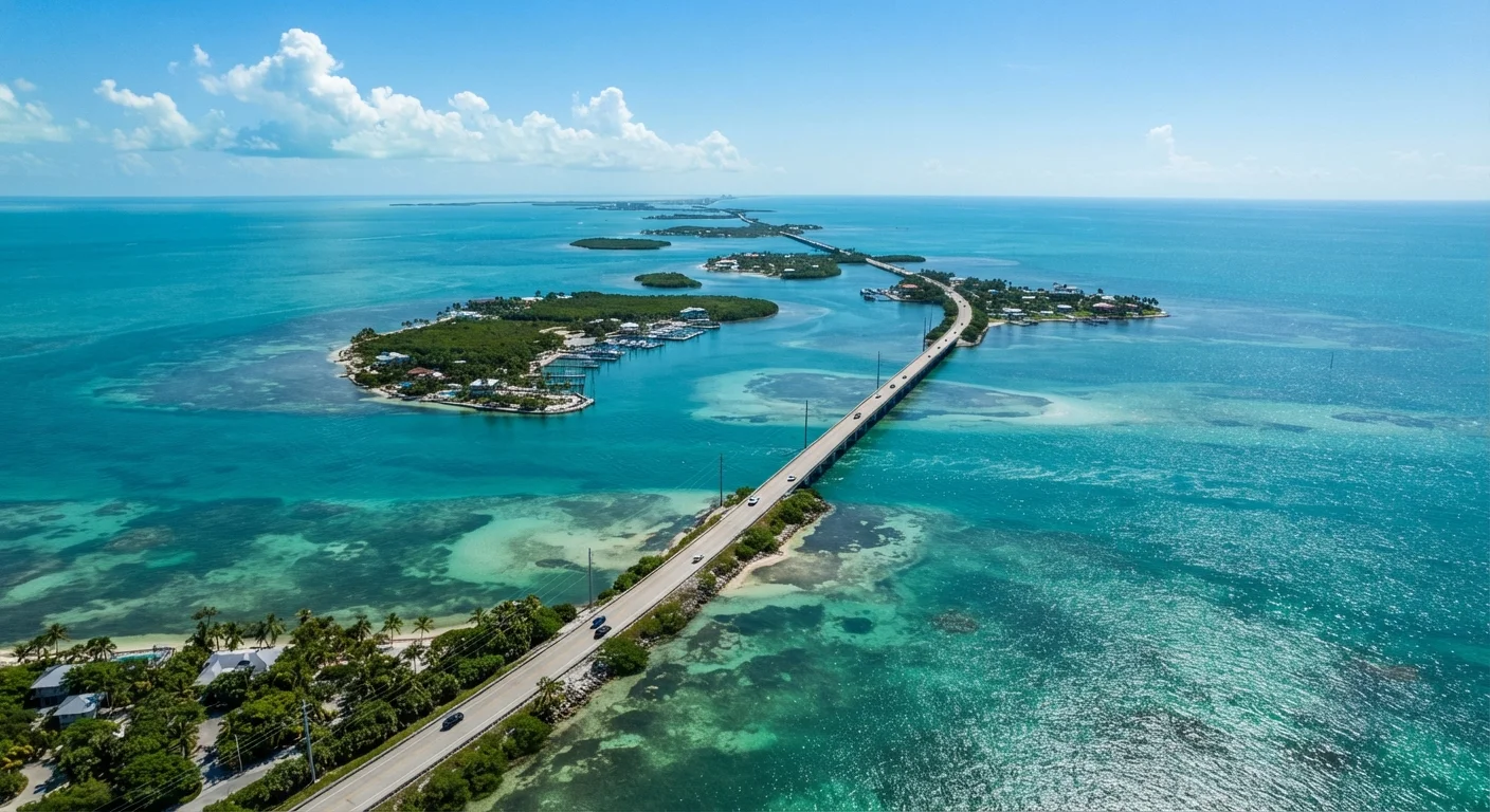
Photo credit: InfoHorizon.net | Access To Informative Content
In this article
- Understanding the Mile Marker System
- Key Largo (MM 106–MM 90): The Gateway to the Reef
- Islamorada (MM 90–MM 74): Sport Fishing Capital
- Marathon & the Middle Keys (MM 74–MM 40): Family-Friendly Middle Ground
- Big Pine & the Lower Keys (MM 40–MM 10): Wild and Unhurried
- Key West (MM 0): The Legendary End of the Road
- Planning Your Drive: Tips for Every Traveler
Key Largo to Key West and every island in between—here's what each stretch of the Overseas Highway realistically offers visitors.
Key Takeaways
- Mile markers count down from MM 126 near Florida City to MM 0 in Key West.
- Each island cluster has a distinct personality — divers head to Key Largo, anglers to Islamorada.
- The drive is roughly 3 hours non-stop; most visitors spend 3–7 days exploring.
- Crowds and prices peak December through April; summer brings heat but fewer tourists.
- Always verify current bridge conditions, ferry schedules, and entry requirements before traveling.
Understanding the Mile Marker System
The Overseas Highway (US Route 1) is the single road threading together all of the Florida Keys, and it runs by a surprisingly simple navigation system: green roadside signs called mile markers (MM). Numbers decrease as you drive south, starting around MM 126 near Florida City on the mainland and ending at MM 0 in Key West. Locals use these markers the way city dwellers use street addresses — restaurants, dive shops, and resorts all give their location by MM number.
Understanding this system transforms the drive from a vague scenic route into a navigable itinerary. Think of the Keys as five distinct zones, each with its own tempo, attractions, and traveler personality. Whether you have a long weekend or a full week, knowing what lives at each stretch helps you allocate time wisely.
113
Miles of Overseas Highway through the Keys
US Route 1 connects 42 inhabited islands from Key Largo to Key West across 113 miles of bridges and causeways.
42
Inhabited islands in the Florida Keys chain
The Florida Keys Visitors Bureau estimates 42 islands with permanent populations along the archipelago.
7
Miles spanned by the Seven Mile Bridge
Completed in 1982, the Seven Mile Bridge near Marathon is one of the longest segmental bridges in the world.
Key Largo (MM 106–MM 90): The Gateway to the Reef
Key Largo announces itself as the dive capital of the world — and for good reason. John Pennekamp Coral Reef State Park, the first undersea park in the United States, sits just offshore, offering snorkeling and scuba access to living coral formations teeming with tropical fish. Glass-bottom boat tours run daily and are an excellent no-equipment option for first-timers.
Above water, the town itself is quieter and more low-key than Key West — mangrove-lined shorelines rather than rowdy nightlife. It's the natural starting point for road-trippers arriving from Miami, and a logical one-night stop if you're not rushing south.
Best Time to Dive in Key Largo
Water visibility in John Pennekamp Coral Reef State Park tends to peak in the dry season (roughly November through April) when winds are calmer and runoff is minimal. Summer diving is still excellent, but afternoon thunderstorms can interrupt schedules. Always confirm conditions with your operator on the morning of your trip.
Islamorada (MM 90–MM 74): Sport Fishing Capital
Spread across several small islands, Islamorada carries the official title of Sport Fishing Capital of the World. The flats here — shallow, clear water stretching toward the horizon — draw serious anglers chasing bonefish, tarpon, and permit. Charter boats depart most mornings, and guides range from multi-day offshore expeditions to half-day backcountry pole trips.
Non-anglers find plenty of appeal too. Robbie's Marina is a beloved stop where visitors hand-feed enormous tarpon from a dock — one of the most memorable $5 activities in the entire Keys chain. Sunset is practically a religion here, with waterfront spots filling up well before dusk.
“The Florida Keys are not a single destination — they're a series of distinct communities that happen to share a road. Each one has its own reasons to stay longer than you planned.”
— Alex Larson, Marine naturalist and Keys-based naturalist guide
Marathon & the Middle Keys (MM 74–MM 40): Family-Friendly Middle Ground
Marathon sits roughly at the geographic midpoint of the Keys and offers one of the most practical bases for families or travelers who want variety without committing to either end of the island chain. The Seven Mile Bridge — one of the longest segmental bridges in the world — begins here and offers jaw-dropping open-water views in both directions.
The Turtle Hospital, a working rehabilitation center for injured sea turtles, runs educational tours that are consistently popular with visitors of all ages. Crane Point Hammock preserves a rare slice of native vegetation and archaeological history. Marathon also has a full-service airport (EYW's smaller neighbor, MTH), making it a viable fly-in option.
Book your dive charter or fishing guide before you book your hotel — top captains fill up weeks ahead, especially in peak season.
Guided water experiences are the defining activity in most Keys destinations, and availability drives the rest of your scheduling.
Pack a cooler with drinks and snacks for the drive; options between mile markers can be sparse and pricier than you'd expect.
The Keys' relative isolation means gas stations and grocery stores are spaced further apart than on the mainland, particularly in the Lower Keys.
Big Pine & the Lower Keys (MM 40–MM 10): Wild and Unhurried
Below Marathon, the Keys shift noticeably quieter. Big Pine Key is home to the National Key Deer Refuge, protecting the diminutive Key deer — a subspecies of white-tailed deer found nowhere else on Earth. Speed limits drop significantly through the refuge, especially at dawn and dusk, and drivers should take this seriously.
Looe Key, accessible by boat from Big Pine, is considered one of the finest shallow reef diving sites in North America. The Lower Keys overall attract travelers who prioritize nature and solitude over nightlife, making this stretch ideal for kayakers, birders, and anyone seeking a genuinely unhurried pace.
Verify Conditions Before You Travel
Bridge closures, red tide events, and hurricane-related road damage can affect travel along the Overseas Highway with little advance notice. Check Florida 511 (the state's traffic information system) and Monroe County Emergency Management before your trip. Travel insurance that covers trip interruption is worth understanding for Keys itineraries, especially during hurricane season.
Key West (MM 0): The Legendary End of the Road
Arriving at MM 0 carries a real sense of occasion. Key West is simultaneously a working city of roughly 25,000 residents and one of the most visited destinations in Florida. Duval Street anchors the tourist experience — restaurants, bars, galleries, and shops stretch for blocks — but the surrounding neighborhoods reward those who wander off the main drag.
Fort Zachary Taylor Historic State Park offers the best public beach on the island, while the Ernest Hemingway Home and Museum draws literary travelers. The Dry Tortugas National Park, a ferry or floatplane ride away, adds one of the most remote and photogenic fort experiences in the country. Sunset at Mallory Square, where street performers gather nightly, is pure Keys tradition.
Planning Your Drive: Tips for Every Traveler
The non-stop drive from Key Largo to Key West takes roughly three hours, but no one should do it that way. Building in stops every 20–30 miles keeps the experience enjoyable rather than exhausting. Traffic between MM 110 and MM 95 can slow significantly on Friday afternoons and Sunday evenings — plan accordingly.
Accommodations range from roadside motels to waterfront resorts. Rates rise sharply December through April, while summer brings genuine deals alongside heat and humidity. Hurricane season runs June through November; always check weather forecasts and heed any official advisories before traveling.
For a fuller framework on structuring multi-day drives, see our guide to planning an American road trip — the same core principles apply beautifully to the Overseas Highway.
Florida Keys & Key West Official Tourism Guide
The official destination guide covers events, island maps, and current conditions across all Keys communities — a reliable starting point for trip planning.
John Pennekamp Coral Reef State Park Info
Florida State Parks maintains current hours, tour availability, and reservation requirements for Pennekamp — essential reading before any dive or snorkel visit.
Florida 511 Traffic & Road Conditions
Real-time bridge status, road closures, and traffic alerts along US-1 through the Keys — check before you leave and again the morning you depart.

Author
Travel Editorial Team
Travel Editorial Team is the collective byline for our editorial team and contributor network. Articles published under this byline or an editorial pen name are researched, written, and reviewed according to our editorial standards for clarity, consistency, and independence before publication.
View all articles →